
Aerial Topo Mapping
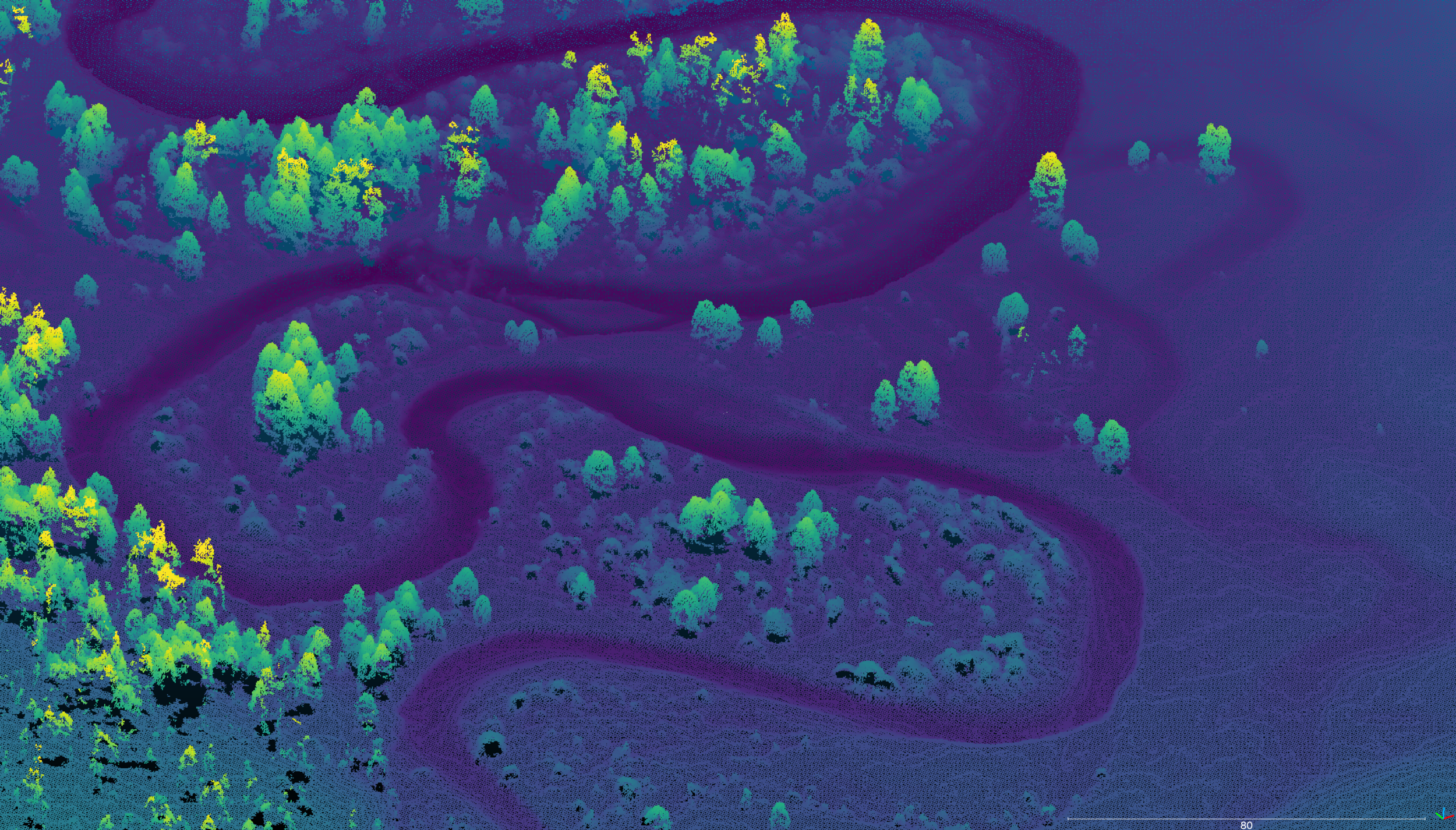
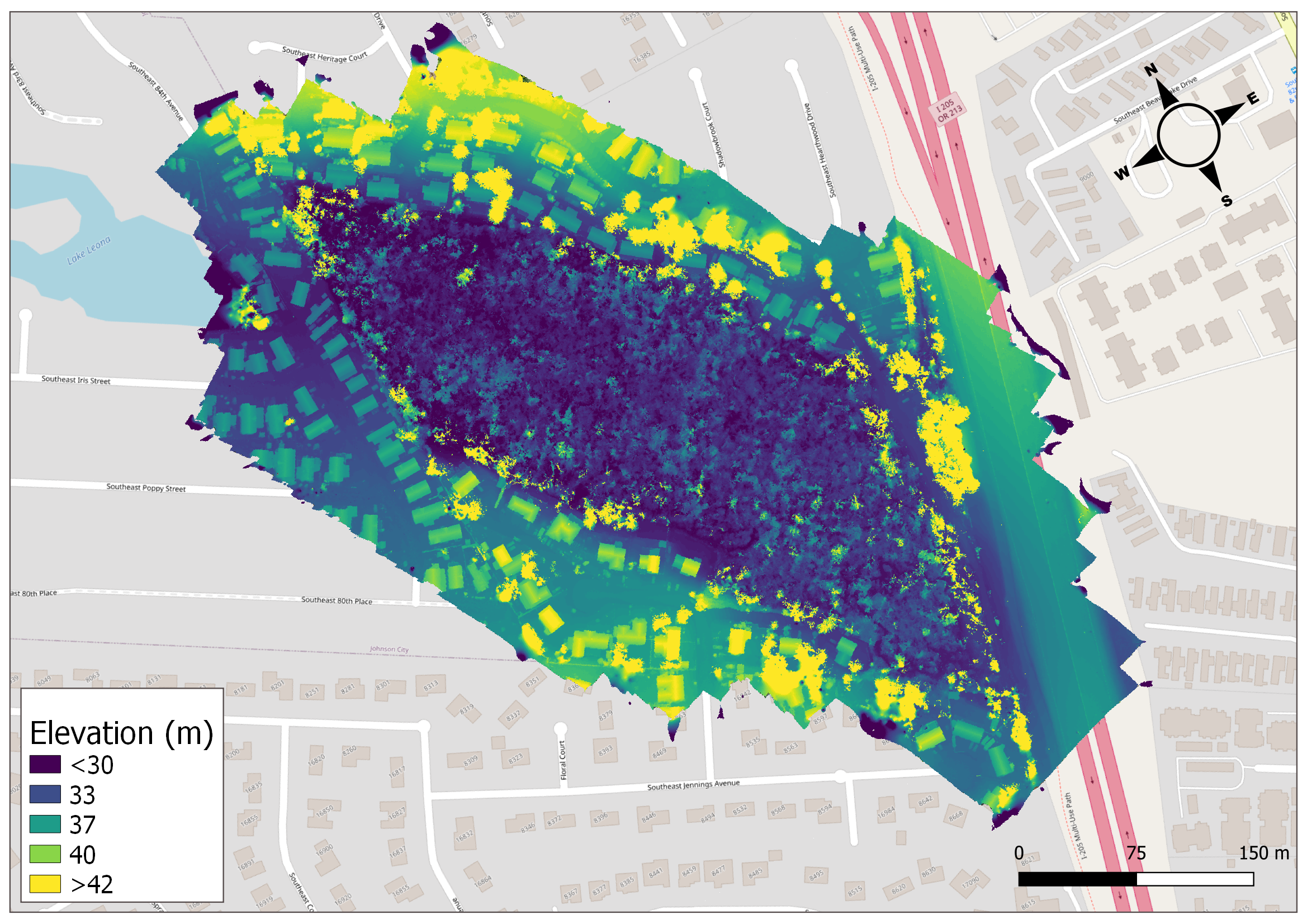
Aerial Topo Mapping is similar to Aerial Mapping, but adds a third dimension by mapping elevation. Aerial Topo Mapping can be achieved using two different techniques: Structure from Motion, and LiDAR.
Structure from Motion topo mapping is a form of photogrammetry, and uses many overlapping images, taken from different vantage points (stereoscopic vision) and geometry to reconstruct a landscape in three dimensions.
LiDAR topo mapping uses a Light Detection and Ranging payload to repeatedly measure the distance between the sensor and the objects below - trees, buildings, ground, water. The collection of measurements are combined into a digital elevation model of the landscape.

Better insights with custom elevation data
➜ Capture the intricacies of 3D terrain and features seamlessly in DEM and point cloud data formats.
➜ Allow stakeholders the convenience and immersion of touring your site remotely through a 3D Story Map
Bridge the gap between intricate data and tangible understanding
➜ Witness and measure the evolution of topographic shifts over time using repeated Aerial Topo Maps.
➜ Engaging, insightful, and cutting-edge. Our interactive 3D Story Maps are tailored not only to provide comprehensive data but also to captivate the next generation of followers
Deliverables
✔︎ High resolution elevation data in raster format (GeoTIFF) or point cloud (.las)
✔︎ Compatible with all major GIS software suites
✔︎ Pair with our GIS Analysis service to turn raw data into insights:
cut/fill analysis, Canopy Height Model (CHM), erosion and deposition, stockpile volumes, cross-section analysis, and more.
What Our Partners Say
Our Work Process
1
Planning
Based on your needs, we develop an appropriate flight plan to capture your area of interest. We plan for the resolution needed to get the data you need, with the accuracy you demand. We handle all FAA authorizations, planning for hazards, and logistics of flight operations.
2
Pre-Production
Select the right payload for the job: RGB (Red, Green, Blue) for Structure from Motion or a LiDAR payload with the right specifications for your requirements.
3
Field Operations
Our team of FAA Part 107 certified pilots will come to your site and fly an automated flight path to capture many overlapping images or LiDAR data over the entire area of interest. One or many flights may be needed depending on the size of the area. We deploy a series of Ground Control Points (GCPs) to ensure the accuracy needed to integrate with existing datasets, and for future repeatability.
4
Post-Processing
We use specialized software and high performance computers to correct for lens distortion and digitally “stitch” all of the images together into one large, orthorectified and geolocated image - an orthomosaic. Additionally, Structure from Motion processing uses stereoscopic geometry to generate a Digital Elevation Model (DEM). Or, with LiDAR, the point-cloud is filtered and classified to ensure a high quality final product.
5
Analysis
Once you have an orthomosaic and DEM, or point cloud, the possibilities for GIS analysis for classification, counting, measuring and making insights is limitless. Explore our GIS Analysis offerings.
Applications
See our comprehensive list of applications for aerial imagery and topo mapping.
-
With climate change and warmer waters threatening ecological collapse, practitioners are prioritizing riparian canopy cover for cooler waters and improved habitat. CHM's are the tool for analyzing the current conditions on a landscape scale, and prioritizing limited resources to the reaches with the greatest potential impact.
-
Comparing elevation models over time can reveal insights about the movement of soils and water in dynamic landscapes, or in ongoing restoration projects. Measure changes for better planning, and reporting.
-
An invaluable tool in river restoration, for baseline assessments, monitoring changes, and identifying restoration opportunities.
-
Elevation plays a huge role in riparian planting plans, and river, estuary, and wetland restoration. At less than 5cm/pixel, drone-based Aerial Topo Mapping provides rich elevation data on the landscape scale.
-
Elevation data assists in identifying low-lying or subsiding areas that are particularly vulnerable to sea level rise. This information is crucial for prioritizing adaptation efforts and implementing protective measures.
-
Aspect, slope, and elevation all factor in to micro-habitats and ecological niches. Rich elevation data inform precision planting plans for higher diversity and survival rates.

FEATURED CASE STUDY
Quantifying Oregon State Forest Landslides Using UAV Structure from Motion
FAQs
-
Aerial Topo Mapping is a technique for creating three-dimensional maps of a landscape. It involves capturing elevation data along with traditional two-dimensional mapping to provide a comprehensive topographical view.
-
While standard aerial mapping provides a two-dimensional view of an area, aerial topo mapping adds a third dimension, mapping elevation to give a more detailed and accurate representation of the landscape and vegetation.
-
Structure from Motion (SfM) is a photogrammetry technique using overlapping images from different vantage points to reconstruct a landscape in 3D. LiDAR (Light Detection and Ranging) involves using laser pulses to measure distances to the ground and objects, creating a digital elevation model.
-
Each method has its advantages. SfM is often more cost-effective and can provide high-resolution images. LiDAR is highly accurate, particularly in dense vegetation areas, and is less affected by lighting conditions.
-
Yes, both SfM and LiDAR are effective in various environments, including forested and urban areas. LiDAR is particularly advantageous when ground elevation is needed beneath a dense canopy.
-
Applications include urban planning, environmental studies, flood risk assessment, river geomorphology, habitat assessments, sustainable forestry, archaeology, and many more.
-
The accuracy depends on the technique used and the conditions of the survey. ForeSight can provide data that meets your accuracy needs.
-
We provide the data in various digital formats, compatible with GIS and other analysis software, according to client specifications.
-
Absolutely, the topographical data we provide can be integrated with existing GIS databases for more comprehensive analysis.
-
Aerial Topo Mapping may be subject to aviation and privacy laws. We ensure compliance with all relevant regulations and obtain necessary permts.
Other Services
-
![]()
360° Virtual Tours
Give your audience an experience. Engage the next generation of followers
-
![]()
Aerial Mapping
Monitor better with a high-res photo map of your site. Chronicle your site and measure changes over time.
-
![]()
3D Story Mapping
Wow funders with guided virtual tours of your site in 3D. Engage the next generation of supporters.
-
![]()
Photo-Point Monitoring
Tell the story of seasonal and restoration changes on a landscape scale
-
![]()
Aerial Photo & Video
Tell the story of your work with rich and eye-catching visuals from above
-
![]()
GIS Analysis
Turn raw aerial data into actionable insights. Answer research questions and report to stakeholders.
-
![]()
Drone Training
Build drone capacity in-house. We develop custom curricula tailored to your organization and team needs.




Interested in aerial topo mapping?
Stay informed with the latest updates! Learn how Foresight Drones is collaborating with local organizations to positively influence the Pacific Northwest ecology.